


Map2Fly
Description of Map2Fly
Map2Fly is an application designed for drone pilots, providing essential information regarding flight regulations, airspace, and ascent rules. The app caters to both recreational and professional users, making it a versatile tool for anyone interested in flying drones. It is available for the Android platform, allowing users to download Map2Fly and access its features easily.
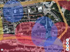
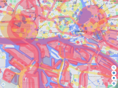
The application integrates data from over 180 sources to ensure accurate information about flight zones and geodata. This high level of accuracy is crucial for drone operators, as it helps them adhere to regulations and avoid restricted areas during their flights. By utilizing this extensive data, users can trust that they are receiving current and relevant information specific to their location.
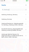
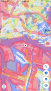
Upon opening Map2Fly, users can quickly identify the applicable conditions for their chosen area. The app presents a straightforward display, minimizing the need for extensive research or communication with authorities. This efficiency is particularly beneficial for those who may not be familiar with local regulations or for those planning to fly in unfamiliar territories.
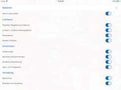
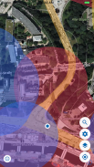
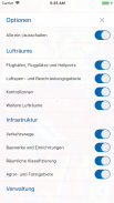
Another useful feature of Map2Fly is its ability to show and hide various airspace classifications and restrictions. Users can customize the map to their preferences, selecting from five different map modes. This customization allows for a more tailored experience, ensuring that users can focus on the specific information most relevant to their flight plans.
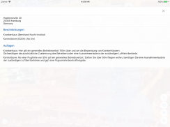
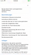
The app also includes tools for marking locations and determining altitude. These functionalities are important for users to maintain situational awareness while flying, helping them to stay within legal limits and avoid potential hazards. The ability to track altitude is particularly valuable for those flying in areas with varying terrain or obstacles.
Map2Fly allows users to create flight projects, which can be shared with other pilots. This collaborative aspect of the app encourages community engagement among drone enthusiasts and promotes safe flying practices. Users can manage their profiles within the app, including proof of knowledge and details about their specific drone type. This feature not only personalizes the user experience but also fosters a sense of accountability and expertise among the community.
In addition to its mobile app, Map2Fly offers an online platform with additional functions. Users can access the web app at www.map2fly.de, where they can further manage their flight projects and data. The online platform enhances the overall user experience, providing tools for data storage and export functions, making it suitable for professional applications as well.
The app's design prioritizes user-friendliness, ensuring that individuals of various skill levels can navigate its features with ease. By streamlining the process of obtaining flight-related information, Map2Fly supports users in making informed decisions about their drone flights.
With ongoing improvements made by the community, the app is consistently updated to reflect changes in regulations and airspace designations. This commitment to accuracy and relevance is a significant advantage for users, as they can rely on the app to provide the latest information necessary for safe and compliant flying.
In essence, Map2Fly is an essential tool for anyone involved in drone operations. Its combination of accuracy, efficiency, and user-friendly features makes it a valuable resource for both amateur and professional drone pilots. By providing clear information about airspace regulations and ascent rules, the app empowers users to fly responsibly and within legal limits.
The ability to customize the display according to individual preferences further enhances the app’s functionality, allowing users to tailor their experience based on their specific needs. With the added capability of sharing flight projects with fellow pilots, the app fosters a collaborative environment that promotes safety and knowledge sharing within the drone community.
For those looking to improve their flying experiences while ensuring adherence to regulations, downloading Map2Fly is a practical step. By doing so, users can access a wealth of information and tools designed to facilitate safe and enjoyable drone operations. The combination of accurate data, customizable features, and community engagement makes Map2Fly a comprehensive solution for drone pilots in Germany.
For more information and to explore its features further, visit www.map2fly.de.
Map2Fly - Version 3.2.4
(17-08-2024)Map2Fly - APK Information
APK Version: 3.2.4Package: com.map2flyLatest Version of Map2Fly
Other versions


Apps in the same category


You may also like...


